Machame Route now vies with – and indeed over the last few years has overtaken – the Marangu Route as the most popular trail. Machame is also the regarded by many guides as the most enjoyable, though it is longer and, according to most, more arduous. Despite this, the success rate on the Machame Route is higher than on the Marangu Route, possibly because the Machame is a day longer at six days and five nights (assuming you take the Barafu Route to the summit) which gives trekkers more time to acclimatize. An extra acclimatization day can – and usually is -taken in the Karanga Valley. The Machame Route also gives you the option of taking the Western Breach / Arrow Glacier Route to the summit.
Trekking Overview
Trekking Itinerary
DAY 1: Machame Gate to Machame Camp
•Elevation (ft): 5,400ft to 9,400ft
•Distance: 11 km
•Hiking Time: 5-7 hours
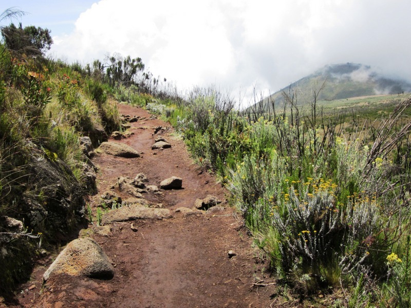
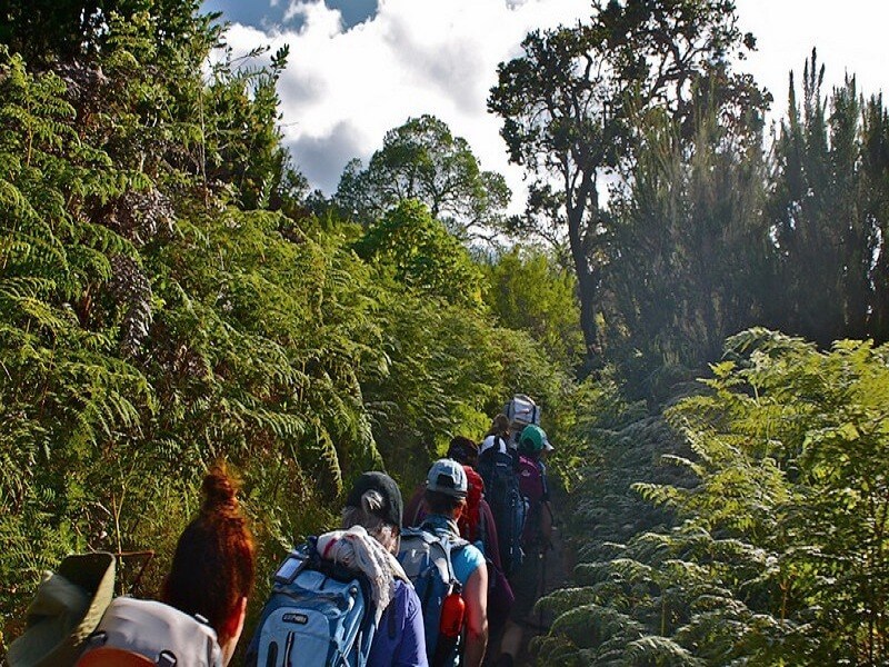
•Habitat: Rain ForestThe drive from Moshi to the Mount Kilimanjaro National Park Gate takes about 50 minutes. The journey passes through the village of Machame which is located on the lower slopes of the mountain. We now leave the park gate and walk through the rain forest on a winding trail up a ridge. Lower down, the trail can be muddy and slippery. Gaiters and trekking poles are a good idea here. We continue a short distance until we reach the Machame Camp.
DAY 2: Machame Camp to Shira Camp
•Elevation (ft): 9,400ft to 12,500ft
•Distance: 5 km
•Hiking Time: 4-6 hours
•Habitat: MoorlandAfter breakfast, we leave the glades of the rainforest and continue on an ascending path, crossing the little valley walking along a steep rocky ridge, covered with heather, until the ridge ends. The route now turns west onto a river gorge. Time for rest, dinner, and overnight at the Shira campsite.
DAY 3: Shira Camp to Lava Tower to Barranco Camp
•Elevation (ft): 12,500ft to 13,000ft
•Distance: 10 km
•Hiking Time: 6-8 hours
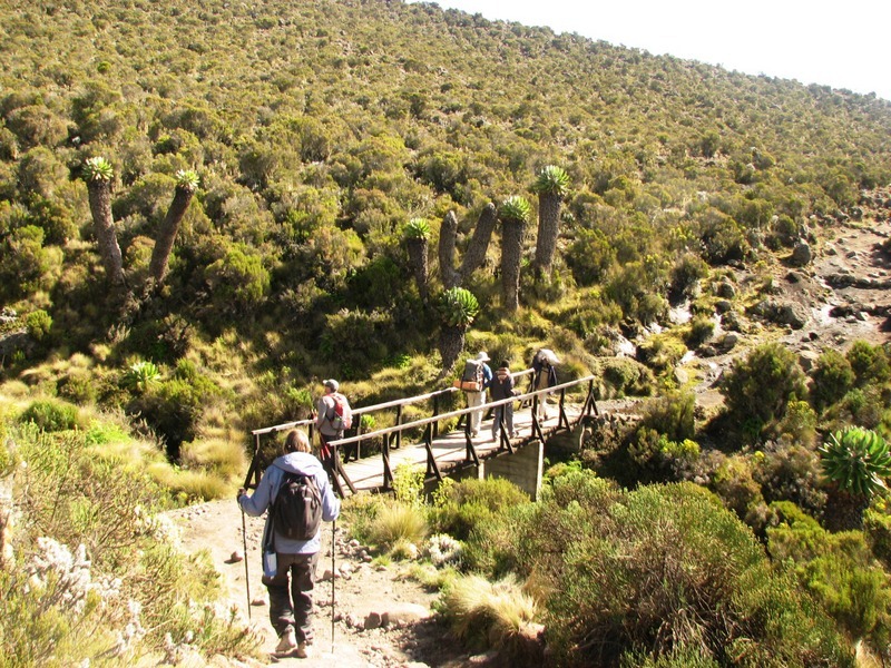
•Habitat: Semi DesertFrom the Shira Plateau, we continue to the east up a ridge, passing the junction towards the peak of Kibo. As we continue, our direction changes to the South East towards the Lava Tower, called the “Shark’s Tooth.” Shortly after the tower, we come to the second junction which brings us up to the Arrow Glacier at an altitude of 16,000ft. We now continue down to the Barranco Hut at an altitude of 13,000ft. Here we rest, enjoy dinner, and overnight. Although you end the day at the same elevation as when you started, this day is very important for acclimatization and will help your body prepare for summit day.
DAY 4: Baranco Camp to Karanga Camp
.Elevation: 13,000ft to 13,100ft
.Hiking time: 4-5 hours
.Distance: 3 miles
.Habitat: Alpine DesertAfter breakfast, we leave Barranco and continue on a steep ridge passing the Barranco Wall, to the Karanga Valley campsite. This is a short day meant for acclimatization. Elevation: 13,000ft to 13,100ft Hiking time: 4-5 hours Distance: 3 miles Habitat: Alpine Desert
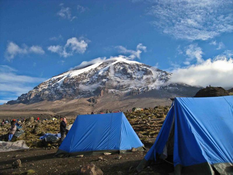
DAY 5: Karanga Camp to Barafu Camp
After breakfast, we leave Karanga and hit the junction which connects with the Mweka Trail. We continue up to the Barafu Hut. At this point, you have completed the South Circuit, which offers views of the summit from many different angles. Here we make camp, rest, enjoy dinner, and prepare for the summit day. The two peaks of Mawenzi and Kibo are to be seen from this position.
Elevation: 13,000ft to 15,300ft
Hiking time: 4-5 hours
Distance: 2.5 miles
Habitat: Alpine DesertDAY 6: Elevation: 15,300ft to 19,340ft to 10,000ft
Hiking time: 12 – 15 hours
Distance: 3 miles to Summit; 7 miles descent
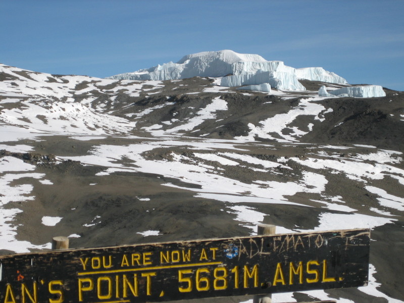
Habitat: ArcticVery early in the morning (midnight to 2am), we continue our way to the summit between the Rebmann and Ratzel glaciers. You head in a northwesterly direction and ascend through heavy scree towards Stella Point on the crater rim. This is the most mentally and physically challenging portion of the trek. At Stella Point (18,600 ft), you will stop for a short rest and will be rewarded with the most magnificent sunrise you are ever likely to see (weather permitting). From Stella Point, you may encounter snow all they way on your 1-hour ascent to the summit. At Uhuru Peak, you have reached the highest point on Mount Kilimanjaro and the continent of Africa. Faster hikers will see the sunrise from the summit. From the summit, we now make our descent continuing straight down to the Mweka Hut camp site, stopping at Barafu for lunch. You will want gaiters and trekking poles for the loose gravel going down. Mweka Camp is situated in the upper forest and mist or rain can be expected in the late afternoon. Later in the evening, we enjoy our last dinner on the mountain and a well-earned sleep.
DAY 7.Mweka Camp to Mweka Gate
Elevation: 10,000ft to 5400ft
Hiking time: 3-4 hours
Distance: 6 miles
Habitat: Rain ForestAfter breakfast, we continue the descent down to the Mweka Park Gate to receive your summit certificates. At lower elevations, it can be wet and muddy. Gaiters and trekking poles will help. Shorts and t-shirts will probably be plenty to wear (keep rain gear and warmer clothing handy). From the gate, you continue another hour to Mweka Village. A vehicle will meet you at Mweka village to drive you back to hotel in Moshi.

Package Includes:
Pre & Post Trek accommodation
Professional guides, cooks and porters
Transportation to & from the mountain gate
Park fees, camping fees & rescue fees
VAT fees and Charges
Double layered Sleeping Mats
3 meals daily while on the mountain
Filtered water throughout the trek
Portable toilets and toilets tents
Hot Water For Washing Purpose
Pick up and drop off at the airport.
Fair wages for the mountain crew.
Package does not Include:
International flights
Tip to the driver guide and hoteliers
Insurance fees
Cost of Tanzania Visa.
Bank charges
Personal Expenses